Advertisement

We need your help now

Support from readers like you keeps The Journal open.

You are visiting us because we have something you value. Independent, unbiased news that tells the truth. Advertising revenue goes some way to support our mission, but this year it has not been enough.

If you've seen value in our reporting, please contribute what you can, so we can continue to produce accurate and meaningful journalism. For everyone who needs it.
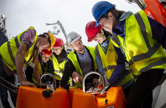
Researchers pictured at the launch in Cobh today. Cathal Noonan
deep dive

How Irish researchers will explore Atlantic Ocean over next two years

18 state-of-the-art seismometers will measure movement at the floor of the ocean.

A LARGE-SCALE exploration of the Atlantic Ocean was launched in Cobh, Co Cork today.

The SEA-SEIS project is one of the largest deep-ocean research projects ever undertaken in Europe.

It will deploy 18 state-of-the-art seismometers to measure movement at the floor of the Atlantic Ocean, hundreds of kilometres off the coast of Ireland.

The network will cover the entire Irish offshore area, with several sensors also being placed in British and Icelandic waters.

The seismometers will be in place for the next two years. The equipment will be deployed on a mission on the RV Celtic Explorer over the next three weeks, with the ship returning to dock in Galway on 7 October.

Speaking at today’s launch, Professor Chris Bean, Senior Professor of Geophysics at the Dublin Institute for Advanced Studies (DIAS), said: “The geological evolution of Ireland’s offshore territory is fascinating, but there is still so much of it to be explored.”

DIAS and other collaborators confirmed in the late 1980s that Ireland has an ocean territory 10 times larger than its terrestrial landmass.

90% of the Irish territory is offshore

Lead researcher Dr Sergei Lebedev, from DIAS, added that Ireland is “uniquely suited to this type of deep-sea science, as 90% of the Irish territory is offshore, most of it to the west of Ireland”.

“The ocean-bottom sensors will record the tiny vibrations of the Earth caused by seismic waves, generated by earthquakes and by the ocean waves.

As the waves propagate through the Earth’s interior on their way to the seismic stations, they accumulate information on the structure of the Earth that they encounter.

“Using this data, the scientists at DIAS can do a 3D scan of the matter beneath the Earth’s surface. We will discover how the structure of the tectonic plates varies and what happens beneath these plates.”

Your Voice
Readers Comments
2
This is YOUR comments community. Stay civil, stay constructive, stay on topic. Please familiarise yourself with our comments policy here before taking part.
Leave a Comment
    Submit a report
    Please help us understand how this comment violates our community guidelines.
    Thank you for the feedback
    Your feedback has been sent to our team for review.

    Leave a commentcancel